
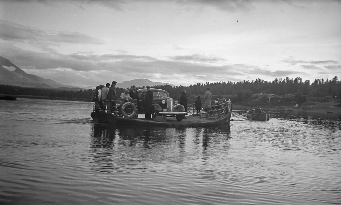
Car ferry on Målselva
Photo: Perspektivet museum
Målselva stretches from the Swedish border to the coast, flowing through Sámi migration routes, forests, cultivated land, and settlements. Throughout history, the river has been of great importance to the people living in the Målselv Valley.
Practical info
Practical info
Opening hours
Outdoors and always open
Other information
An information sign has been installed at Varden near Olsborg, and the "Fotefar" booklet provides excellent information on the historical use of the river and traditions related to fishing, forestry, etc.
A cultural trail named "Fra foss til foss" (From Waterfall to Waterfall) has also been established in Målselv, running between Bardufossen and Målselvfossen. Information signs have been placed at several points along the trail. Visit ut.no for more information.
Accessibility
Accessibility
The cultural trail is not universally accessible, but several locations along the river can be reached by wheelchair.
Målselva lies at the heart of our valley—and perhaps in our souls, too. Flanked by birch and alder trees along its banks, and rising just above the steep river slopes, lie vast, dry pine heaths. What could be better than rowing on the river on a quiet autumn evening, when the fish are biting and time is plentiful? Or sitting on the bank, brewing coffee, and watching the salmon leap as they make their way upstream? These salmon travel great distances up Målselva to spawn.
Dutch traders once came here to harvest timber, fish for salmon, and hunt seals. People from the coast traveled upriver to source timber for various uses. For the settlers arriving from the east and south—from Tornedalen, Østerdalen, and Gudbrandsdalen—the river served as the only route of travel during those early years.
The river’s salmon provided a vital food source; the fish were salted in barrels and consumed throughout the winter. Salmon roe was dried and crushed to serve as a flour substitute in bread during lean times when flour was scarce.
Today, cars and roads have taken the place of boats and the river itself. The river is crossed via bridges, though in winter, ice bridges also provide a way across.
The river remains there, almost tucked away between wooded banks. Try rowing or paddling down the Målselva one afternoon. You will see the river in a new light—no rushing traffic, no busy crowds. The clock matters less; you simply live in rhythm with the river as it flows quietly toward the sea.
By boat, canoe, or kayak on the river
Upstream of Målselvfossen, the river is navigable by small boats as far as the second Divifoss waterfall in Dividalen—a stretch of nearly 80 km. Upstream of Bardufossen, the Barduelva River is navigable for 45 km, reaching as far as Strømsmoen. Downstream of Målselvfossen, the river drops no more than 5 meters in elevation. The effects of the tide are noticeable as far inland as Fagerlidal. Below the waterfalls, Målselva flows quietly and majestically, reaching widths of up to 200 meters. In its lower reaches, the river widens to the point where it is difficult to distinguish the transition between the fjord and the river itself. This area is filled with sandbars and shoals, requiring caution when navigating by boat.
